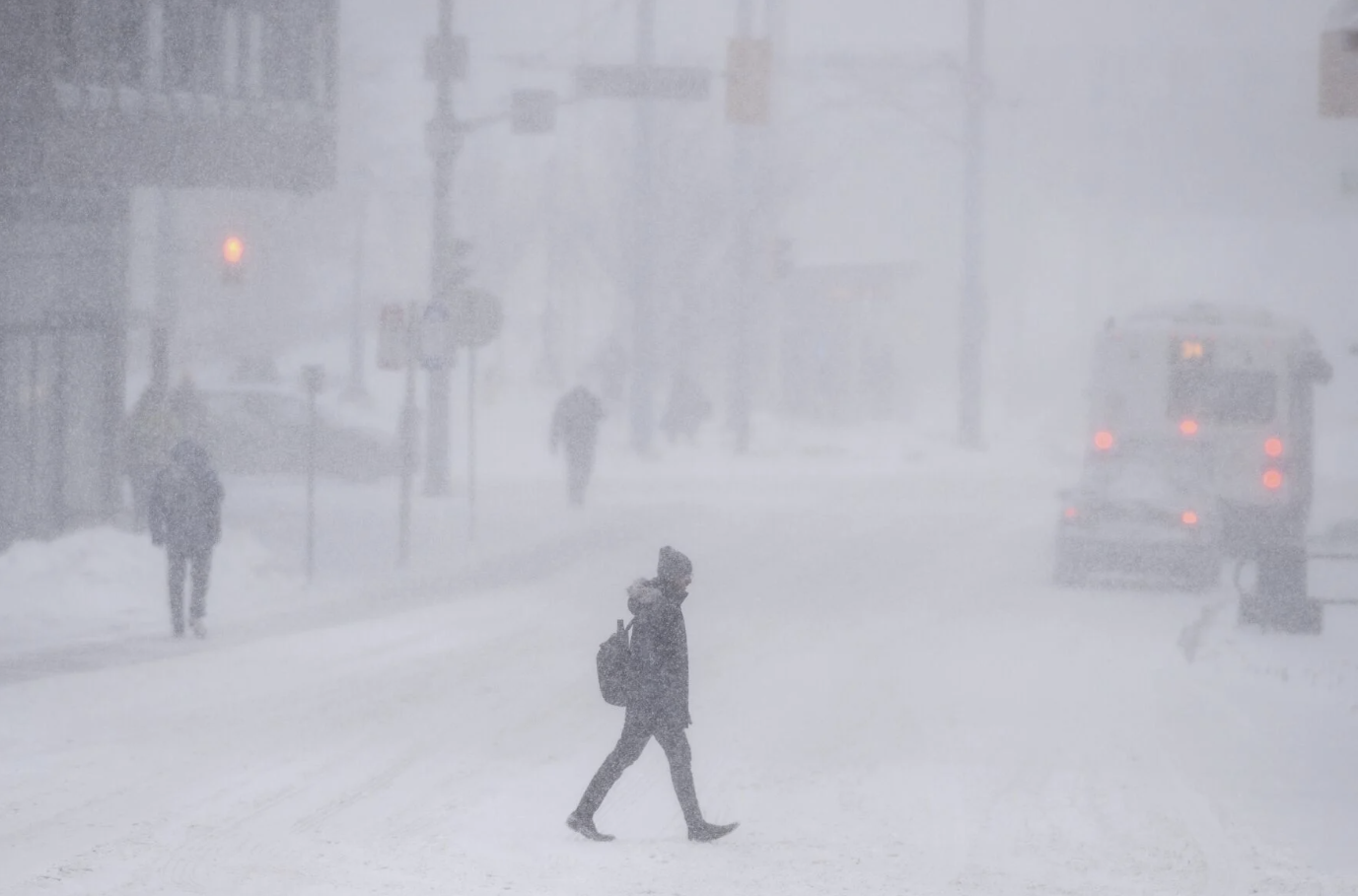
A powerful winter storm is expected to sweep through southern Ontario on Wednesday. It will bring heavy snowfall and travel disruptions. This update comes from Environment Canada. The Greater Toronto Area (GTA) and surrounding regions could see up to 15 cm of snow by Thursday morning. Snowfall will intensify during the evening commute.
Severe Snowfall and Hazardous Conditions
Environment Canada has issued snowfall warnings for several areas, including Mississauga, Brampton, Vaughan, Markham, and Richmond Hill. A more severe winter storm warning is in effect for Barrie, Collingwood, and Hillsdale. In these areas, snowfall totals could reach 30 cm.
Forecasters warn that the heaviest snowfall will occur Wednesday night. Some locations will experience rates of 2 to 4 cm per hour. Certain areas might experience ice pellets mixing with the snow, making road conditions even more hazardous.
Traffic and Travel Disruptions
Drivers should brace for reduced visibility and treacherous road conditions throughout Wednesday evening. Ontario Provincial Police are advising against non-essential travel, as deteriorating conditions could lead to delays and accidents. Those heading to work on Thursday morning should expect icy patches and lingering snowfall, potentially impacting the commute.
Meanwhile, Toronto Pearson International Airport has already reported multiple flight cancellations ahead of the storm. Travelers are urged to check with their airlines for real-time updates before heading to the airport.
Citywide Precautions and Parking Bans
The City of Toronto has declared a significant weather event, enforcing a snow route parking ban starting at 10 p.m. Wednesday. Vehicles parked on these designated routes may be towed, and owners could face fines of up to $200. This measure aims to facilitate snow removal operations. Officials say the operations could take longer than usual due to the severity of the storm.
Residents are reminded not to shovel snow onto streets or sidewalks. Crews work around the clock to clear major routes.
More Snow on the Way?
This storm is expected to ease by Thursday morning. However, meteorologists warn that another round of snowfall could arrive over the weekend. Projections indicate that an additional 35 cm of snow could accumulate by Sunday night, potentially extending travel disruptions.
Authorities urge residents to stay prepared by having emergency supplies on hand, including food, water, medication, and flashlights. For those who need to travel, it is crucial to exercise caution. Allow some extra time as the region battles this significant winter storm.